IE 11 is not supported. For an optimal experience visit our site on another browser.
Science News
Our fragile Earth
Images from outer space highlight the fragility — and the resilience — of our beautiful blue planet.
/ 13 PHOTOS
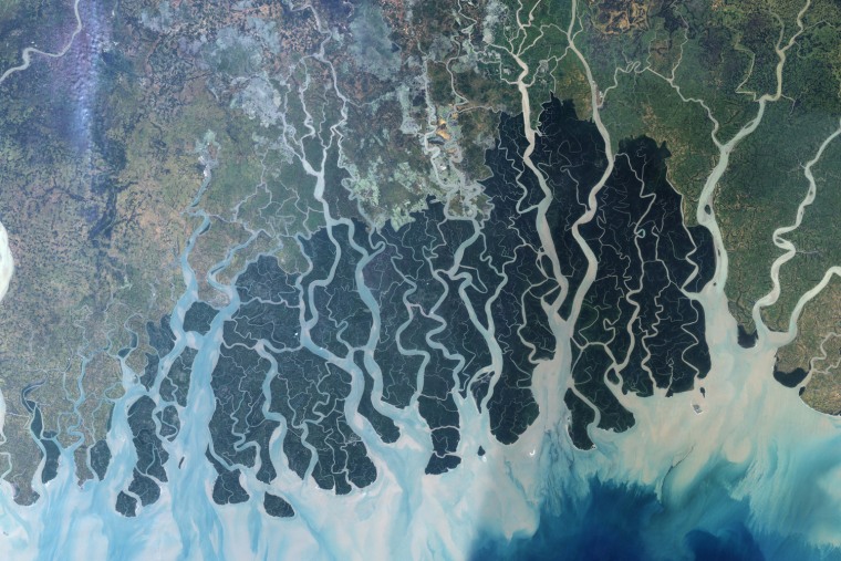
Natural tapestry
Stretching across part of southwestern Bangladesh and southeastern India, the Sundarbans is the largest remaining tract of mangrove forest in the world. The Sundarbans is a tapestry of waterways, mudflats, and forested islands at the edge of the Bay of Bengal. Home to the endangered Bengal tiger, sharks, crocodiles, and freshwater dolphins, as well as nearly two hundred bird species, this low-lying plain is part of the Mouths of the Ganges. The area has been protected for decades by the two countries as a National Park, despite the large human populations concentrated to the north.
This satellite image shows the forest in the protected area. The Sundarbans appears deep green, surrounded to the north by a landscape of agricultural lands, which appear lighter green, towns, which appear tan, and streams, which are blue. Ponds for shrimp aquaculture, especially in Bangladesh, sit right at the edge of the protected area, a potential problem for the water quality and biodiversity of the area. The forest may
— 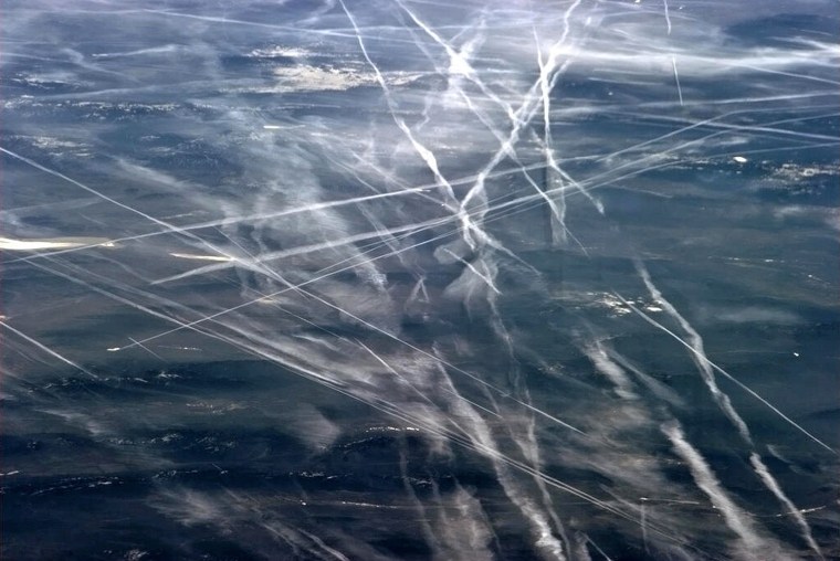
Trails in the sky
This NASA handout image captured by Canadian astronaut Chris Hadfield on board the International Space Staion(ISS) on April 6, 2013, shows contrails from jet traffic over San Francisco. AFP PHOTO/HANDOUT/ NASA / Chris Hadfield = RESTRICTED TO EDITORIAL USE - MANDATORY CREDIT \" AFP PHOTO / NASA / Chris Hadfield \" - NO MARKETING NO ADVERTISING CAMPAIGNS - DISTRIBUTED AS A SERVICE TO CLIENTS =Chris Hadfield/AFP/Getty Images
— Chris Hadfield / AFP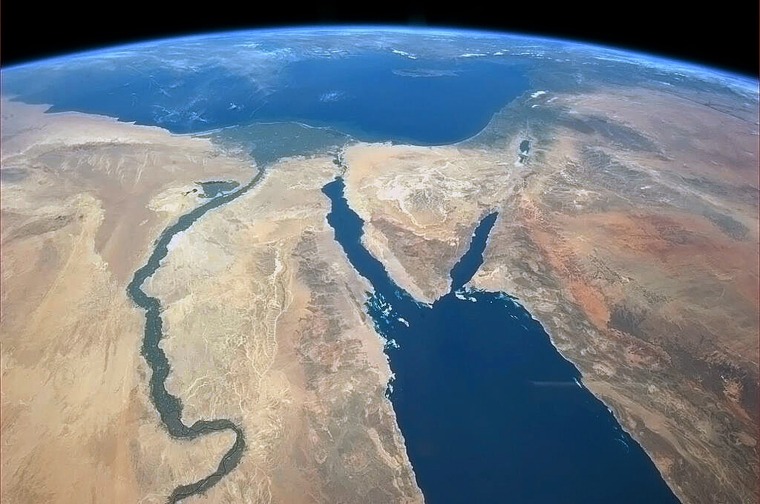
Miles and miles of the Nile
This NASA handout image captured by Canadian astronaut Chris Hadfield on board the International Space Staion(ISS) on March 20, 2013, shows the Nile River, the Nile River delta, the Sinai Peninsula and beyond. AFP PHOTO/HANDOUT/ NASA / Chris Hadfield = RESTRICTED TO EDITORIAL USE - MANDATORY CREDIT \" AFP PHOTO / NASA / Chris Hadfield \" - NO MARKETING NO ADVERTISING CAMPAIGNS - DISTRIBUTED AS A SERVICE TO CLIENTS =Chris Hadfield/AFP/Getty Images
— Chris Hadfield / AFP
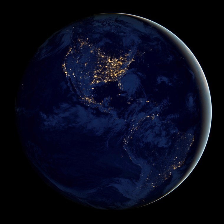
Good night!
NASA Earth Observatory
The night lights of the Americas shine in this visualization of our planet at night, which is based on data acquired by the Suomi NPP satellite in April and October. The image, released by NASA Earth Observatory today, has been nicknamed the \"Black Marble.\"
— 1/13

